


Carta Marina 1000 piece Jigsaw
£38.00
- A Jigsaw of a 1000 pieces
- Re-production of the 1539 original map by Olaus Magnus
- 69 x 48 cm
- Challenging and informative
- Unique lustre, full colour, silk finish
- Made with recycled board
- Produced especially for us by, One Thousand and Out
- Printed in the UK
- NOT suitable for children as contains small parts.
A 1000 piece challenging jigsaw of the truly stunning Carta Marina map dated 1539.
Created in Rome during 1527-1539 by Olaus Magnus, a noted priest, cartographer and historian of his own time, the map took him twelve years to complete and would introduce Europeans to the rich history and culture of the people of Scandinavia, along with a vivid portrayal of terrifying sea monsters, which lurked beneath the waves of the Northern seas.
In stock
Description
Olaus Magnus (October 1490 – 1 August 1557) was a Swedish writer,cartographer and Catholic clergyman. Like his elder brother, Sweden’s last Catholic archbishop Johannes Magnus, he obtained several ecclesiastical preferments, among them a canonry at Uppsala and Linköping, and the archdeaconry of Strängnäs.
Carta marina et descriptio septemtrionalium terrarum is Latin for Marine map and description of the Northern Lands, commonly abbreviated as the Carta Marina. It was the first map of the Nordic countries, giving extensive cultural details and place names. Created by the Swedish ecclesiastic Olaus Magnus and first published in 1539, it is one of the most accurate cartographical productions of its age. The amazing Carta Marina map, contains a level of detail and skill, lacking in many other early maps of Scandinavia and the seas around it. It illustrates the known and the unknown, with its incredible mix of myth, culture and politics.
However, what’s going on in the seas around Scandinavia draws the eye!
The map is a wonderful manifestation of countless sailors’ tales, with the Great Norway Serpent or Sea Orm, a creature of 200ft, being one of the most terrifying creatures they would encounter. Monsters of all shapes and sizes attacking ships, lobsters carrying off sailors and islands morphing into leviathans. Olaus Magnus personally sailed much of the coastline himself, collecting Northern folklore, eyewitness accounts and Christian mythology, which helped with the vivid portrayal of the Northern seas and what lurked beneath them.
Olaus’s original map was made of 9 folio sized woodblocks and with a printed up size of 4ft by 5ft wide, it was the largest paper map to be produced in the 16th century. It was printed in Venice and was the most detailed and accurate map of any part of Europe of that time.
Very few copies were printed as they were very expensive but influenced the charting of Scandinavia, up to the early 17th century.
You may also like…
-


POTOOTY Organics – Lime Basil and Mandarin Hand Wash
Price range: £17.50 through £29.50 Select options This product has multiple variants. The options may be chosen on the product page -


Monstra Marina et Terrestria 1000 piece Jigsaw
£38.00 Add to basket -
 Sale!
Sale!
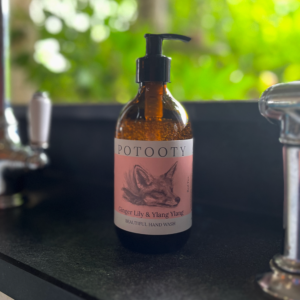
POTOOTY Organics – Ginger Lily and Ylang Ylang Hand Wash
Original price was: £24.50.£19.50Current price is: £19.50. Add to basket
Related products
-

 Out of Stock
Dusky Pink Basket Weave Knee Blanket
£40.00 Read more -

 Out of Stock
Anna Wright Ladies Who Lunch Tray
£28.00 Read more -


Solid Brass OR Chrome Hare Door Knocker
£70.00 Select options This product has multiple variants. The options may be chosen on the product page -

 Out of Stock
Recycled Wool Knee Blanket in Rust Check
£30.00 Read more